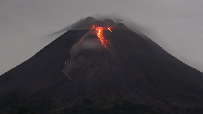
Mount Merapi trasnaltes to Fire Mountain. Located in Indonesia, it is an active stratovolcano between the province of Central Java and the Special Region of the Yogyakarta, Indonesia. Merapi is the most active volcano in Indonesia, erupting regularly since 1548.
Smoke can often be seen emerging from the mountain top. Some of the eruptions have caused fatalities. The largest recent eruption came in 2006, which came before an earthquake, causing more than 5,000 fatalities.
In October 2010, the Indonesian government raised the alert for Merapi to its highest level and warned villagers to move to safer ground.After the large eruption in 2010, the characteristic shape of Mount Merapi was changed. Here are some more facts about the volcano.
Most active volcano in Indonesia
The volcanic mountain peak is located near the centre of the island of Java, Indonesia. It rises to 9,551 feet (2,911m) and has steep slopes with dense vegetation on its lower flanks.
Indonesia has more than 130 active volcanoes, but Mount Merapi remains the largest one. The largest eruption occurred in 1006, spreading ash throughout central Java. Some other major eruptions came in 1786, 1822, 1872, 1930, and 1976.
Almost half of the eruptions have been accompanied by pyroclastic flows, clouds of superheated gases and incandescent solid particles.
Since 1548, the government has counted 68 historic eruptions. The last major one, in 1994, killed 66 people. The volcano has small eruptions every 2-3 years, and bigger ones every 10 to 15 years. Very large eruptions occur every 50 to 60 years.
What makes it so dangerous?
Eruptions at Mount Merapi are more dangerous than Hawaiian eruptions. Why? Because the magma in stratovolcanoes is charged with gas.
As a result, once the magma finds a conduit to the surface, it can build up a sticky, hot, gas-rich plug known as a volcanic dome. This dome can build up higher and higher, and then collapse under its own weight.
What happens is a very dangerous mixture of hot gas, ash, and some dome fragments flowing downhill at 5-10miles because of gravity. They can wipe out anything on ridgetops.
One example came in 2006. Increased seismicity in April caused active lava flows by May. The government ordered more than 17,000 to evacuate from the area. But besides the highest alert status, villagers returned, fearing their livestock and crops would be vulnerable to theft.
![]()
Because of an eruption, a 6.3 magnitude earthquake followed on May 27, killing more than 5,000 people and leaving 200,000 people homeless in the Yogyakarta region.
Monitoring and Safety
Mount Merapi is a site of very active volcano monitoring program. Seismic monitoring at the site began in 1924. Some of the stations remain to this day. Many of the stations have been updated with equipment throughout the years.
During the 1950s and 1960s, low amount of funding caused many of the stations to stop working. But more stable funding came in the 1970s, resulting in considerable improvement of supply of new equipment.
There are also seismographs around the volcano, allowing scientists to monitor and pinpoint the hypocentres of tremors and quakes.
Other measurements include magnetic measurements and tilt measurements.
Following the 2010 eruption, three Indonesian government departments declared a prohibited zone which nobody could stay and no infrastructure is allowed. This sterile zone includes 9 villages.
Myths and legends
Did you know Mount Merapi is important to Javanese? Those living around its crater have come up with lots of myths, legends, and other stories. Here are some.
For example, speaking about the creation, many believe that when the gods created the Earth, Java was unbalanced because of the placement of Mount Jamurdipo on the west end of the island. So, gods wanted to assure balance and move the mountain to the center of Java. Yet, two armorers, Empu Rama and Empu Permadi, didn’t leave the site. They ignored the warning of the gods.
![]()
So, in anger, the gods buried them under Mount Jamurdipi, but their spirits became rulers of all mystical beings in the area. Therefore, in memory of them, the mountain was renamed to Mount Merapi, translating to fire of Rama and Permadi.
To keep the spirits quiet and to appease the spirits of the mountains, Javanese regularly bring offerings on the anniversary of the sultan of Yogyakarta’s coronation. For the Yogyakarta Sultanate, Merapi holds a significant cosmological symbolism, forming a sacred north-south axis line between the peak and the Southern Ocean (Indian Ocean).
Quick Facts
– The name Merapi is derived from the old Javanese language, meaning “the one making fire”
– The volcano produces more nuee ardents than any other volcano on Earth
– Mount Merapi is sacred by local people, as they believe a supernatural kingdom exists there
– It is located above the subduction zone between the Eurasian and Indo-Australian tectonic


